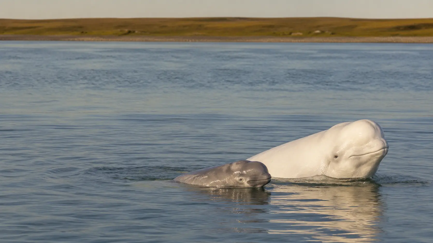
Churchill River estuary · Western Hudson Bay
A nursery
with no walls.
Each summer, the meeting of river and sea creates a shallow, productive refuge where belugas feed, renew their skin, communicate, and raise young.
CHAPTER LANDSCAPEChurchill River estuary
DAILY PEAK3,000–5,000 belugas
CALF COLOURGrey before white
ACCESSRail or air · no road
Where fresh water meets the bay
The river mouth works as habitat, route, and seasonal refuge.
The Churchill River spreads into broad, shallow water before entering Hudson Bay. During the summer aggregation, Parks Canada estimates that 3,000 to 5,000 belugas may explore the estuary each day at peak—one of the clearest examples of how an estuary can concentrate life.
Observation without crowding
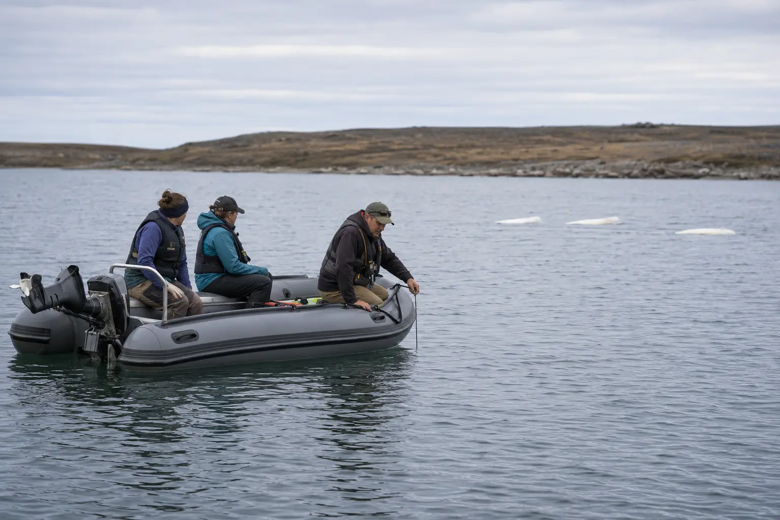
A quieter boat reveals more of what is happening below.
Belugas use sound constantly, while engines add sound to the same water. A trained operator can slow, hold position appropriately, and use a hydrophone to listen without chasing the animals or cutting across their direction of travel.
- 01
Use an established operatorLocal guides understand the estuary, marine mammal rules, weather, tides, and polar bear safety.
- 02
Let the whales choose distanceDo not approach, encircle, touch, or attempt to redirect a group.
- 03
Listen before interpretingClicks, whistles, boat noise, and water movement can overlap; a hydrophone makes that acoustic landscape audible.
Current DFO guidance lists a 50 m minimum in narrow parts of the Churchill and Seal River estuaries and 100 m elsewhere. Always follow the operator's instructions and current regulations.
A relationship measured in seasons
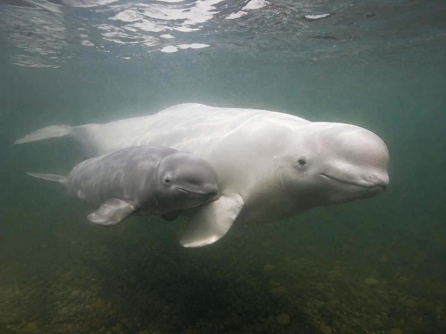
Grey calves learn the river beside white adults.
Beluga calves are born grey or brown and lighten with age. Fisheries and Oceans Canada notes that a calf may remain with its mother for two to three years, long enough to move through repeated migrations while learning feeding areas, social calls, and the shape of familiar water.
- Stay closeA calf often surfaces in the same rhythm as its mother.
- ListenContact calls help maintain social connection in low visibility.
- LearnRepeated routes turn seasonal water into remembered geography.
- LightenGrey juvenile colour gradually gives way to adult white.
Seeing with sound
A click leaves the head.
An echo returns a place.
Belugas produce rapid clicks and focus them through the melon—the rounded structure at the front of the head. When those pulses strike a fish, riverbed, boat, or another object, returning echoes carry information the whale can use in water where vision is limited.
Echolocation turns travel time into distance and reflected sound into spatial detail.
A train of short clicks begins inside the whale's head.
The melon directs sound energy forward into the water.
Returning echoes reveal range, position, and aspects of shape.
The shallow-water advantage
Warm river water and gravel support seasonal skin renewal.
Belugas migrate into northern estuaries for several overlapping reasons. In addition to feeding, calving, and protection, shallow warm water can accelerate skin growth while contact with coarse river-bottom material helps remove an older outer layer.
Sun-warmed water changes the physical conditions.
Coarse substrate supports rubbing during moulting.
River and marine food webs overlap.
The estuary offers space for mothers and young.
MEETS
SALTESTUARY SYSTEM
The landscape under the story
An estuary is a moving boundary, not a line on a map.
Freshwater discharge, tides, sediment, temperature, and prey shift across hours and seasons. Belugas respond to that changing mosaic rather than occupying one fixed point. Useful field observation therefore records time, tide, weather, position, and behaviour together.
Context makes a sighting meaningful. A single surfacing is an event; repeated observations reveal habitat use.
Four relationships to notice
Read the nursery as one connected estuary system.
Water chemistry, family bonds, acoustic information, and vessel behaviour combine to shape what belugas can do—and what an observer can responsibly learn.
≈MIXING
River and tide build a productive seasonal refuge.
Fresh water, marine influence, sediment, and warmth create a changing habitat at the river mouth.
- Fresh water
- Tide
- Sediment
◌LEARNING
Close association turns migration into memory.
A calf follows an experienced adult through surfacing rhythms, social sound, and recurring routes.
- Bond
- Call
- Route
)))ECHO
Cloudy water favours an acoustic view of the world.
Clicks focused through the melon return as echoes from prey, bottom, and obstacles.
- Pulse
- Echo
- Range
△DISTANCE
Less disturbance produces a clearer observation.
Space, steady movement, and lower noise let normal whale behaviour remain the centre of the encounter.
- Guide
- Space
- Listen
Questions from curious explorers
Churchill belugas, answered.
01Why do belugas gather in the Churchill River estuary?+
The shallow estuary supports several summer needs at once, including feeding, calving, caring for young, protection from predators, and seasonal moulting.
02When is the main beluga season?+
Belugas generally arrive from mid-June into July and begin moving north again by mid-September. July and August are the principal visitor season, but timing varies with conditions.
03Why are calves grey?+
Beluga calves are born grey or brown and gradually lighten as they mature. The contrast makes mother-and-calf pairs visually distinctive in summer.
04How does echolocation work?+
The whale produces clicks, focuses them through the melon, and interprets echoes returning from fish, the riverbed, and other objects.
05How close may a vessel approach?+
DFO currently lists a 50 m minimum in narrow parts of the Churchill and Seal River estuaries and 100 m in other areas. Use an established operator and follow current rules.
06How do visitors reach Churchill?+
There is no connecting road. Visitors arrive by scheduled flight or VIA Rail and arrange guided water and land excursions locally.
Research trail
Official sources behind the field guide
Beluga timing, estuary use, calf development, sound, marine-mammal viewing rules, regional geography, access, and safety were checked against Canadian public agencies. Seasonal conditions and services change; confirm them directly before travelling.
Find the chapter landscape
Orient the Churchill River estuary before you step aboard.
This official Parks Canada regional map shows the river mouth, Churchill townsite, Parks Canada Visitor Centre, Cape Merry, Prince of Wales Fort, marina, rail line, airport, and the road toward the Churchill Northern Studies Centre. It is for planning context; use current operator instructions in the field.

 Read the full chapterOpen Story 9 ↗
Continue the Prairie Adventure
Story 9
Beluga Nursery
Join Lumi, Aspen, Hazel, and Barrett at the Churchill River, where a grey calf, a hydrophone, and a quieter boat reveal how beluga families move through water that cannot be read by sight alone.
Opens the chapter page on the main Maple Explorers site.