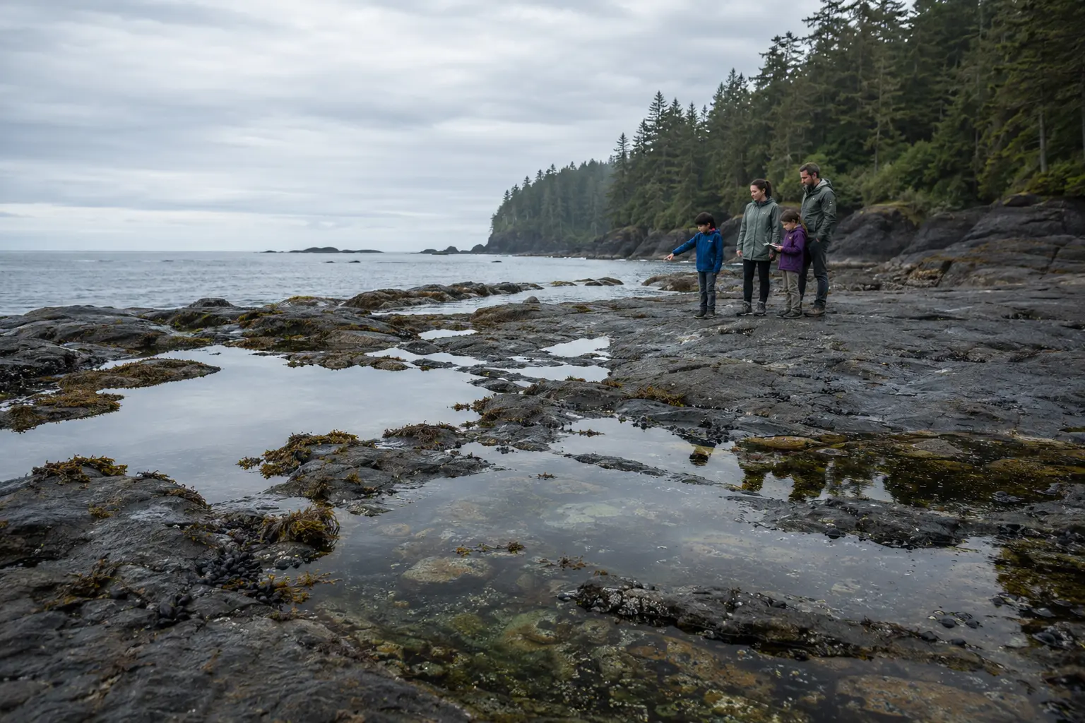
Pacific Rim National Park Reserve · British Columbia
Meet life
between the tides.
At low water, the coast opens a window into a world built for change—bright anemones, gripping mussels, careful crabs, and sea stars beneath a restless Pacific sky.
PLACEPacific Rim National Park Reserve
HABITATRocky intertidal shore
RHYTHMCovered, then exposed
BIG IDEALook closely, touch nothing
Read the shoreline
A tide pool is not a puddle.
The intertidal zone is shoreline that lies underwater at high tide and is exposed to air at low tide. Its animals endure waves, changing water levels, heat, drying, and sudden shifts in salinity—often inside pools no larger than a backpack.
See the shore in context
One coast. One road spine. Many changing shores.
The Long Beach Unit lies between Ucluelet and Tofino on Vancouver Island’s west coast. Detailed shoreline geometry now keeps Tofino visibly connected to the Esowista Peninsula while the mapped road preserves the true coastal order.

Begin with the roadHighway 4 is the regional access spine, with Ucluelet and Tofino at opposite ends of the coastal corridor.
Look west for the oceanThe named beaches and intertidal areas sit on the Pacific-facing side of the route.
Check before exploringTides, waves, closures, and safe shore access change; use current Parks Canada information.
 LOOK · DON’T TOUCH
Family field habits
Let the pool stay wild.
The safest way to explore a tide pool is with patient eyes. Gentle observation protects animals that may already be stressed by sun, air, and receding water.
-
01
Choose stable footingStep only where the route is clearly safe and avoid living surfaces, slippery seaweed, and wave-washed edges.
-
02
Keep hands and buckets awayDo not pry, prod, move, collect, or relocate animals, shells, rocks, or driftwood.
-
03
Watch the oceanTides and waves can change the shoreline quickly; keep an easy return route and follow current official guidance.
Use the official park or government page for current access, conditions, and safety information.
Built for change
Four clues in the intertidal zone
Shape, position, water, and behaviour reveal how shore organisms manage a habitat that never stays the same.
Water line
Wet and dry bands show how often different parts of the shore are covered.
Grip & armour
Tube feet, shells, and strong attachments help animals resist waves and drying.
Pool depth
Deeper pockets may stay cooler and hold water longer as the tide falls.
Shelter
Crevices, shade, and seaweed create small refuges from sun, wind, and predators.
A tiny ocean
One pool. Many survival tools.
Tide-pool residents solve the same challenge in different ways: stay wet, stay attached, find food, and wait for the sea to return.
- Hold fast Mussels, barnacles, and anemones attach to rock in moving water.
- Close up Shells and body surfaces help slow water loss when exposed.
- Find shade Crevices, kelp, and deeper pools soften heat and drying.
- Move carefully Crabs, snails, and sea stars seek food and shelter across the rock.

The coast is always building
Waves shape habitat.
Wind, waves, rain, and time wear rock, move sediment, and carry wood. Driftwood can form temporary shade and shelter, but floating logs can also become dangerous when water rises.

Carry energy shoreward.
Shift the water line.
Creates pools and crevices.
Moves, shades, and shelters.

A repeating rhythm
The Moon helps
move the shoreline.
Tides are driven mainly by the gravitational pull of the Moon and Sun. Along Pacific Rim’s coast, the shore typically widens and narrows twice each day.
Low tide reveals a habitat; high tide returns its ocean.
The exact timing and height always change. The evergreen lesson is to understand the rhythm—and use current official tide and safety information before exploring.

Continue the Pacific Adventure
Story 2
Life Between the Tides
Join the explorers as a disappearing ocean reveals tiny worlds, driftwood creates shade, and a returning tide shows why the best way to protect shore life is simply to watch.
Opens the chapter page on the main Maple Explorers site.
Questions from curious explorers
Field notes, answered.
01What is the intertidal zone?+
It is the part of the shoreline covered by ocean water at high tide and exposed to air at low tide.
02What animals live in Pacific coast tide pools?+
Depending on the location and pool, you may see anemones, sea stars, mussels, barnacles, crabs, limpets, snails, small fish, and many less obvious organisms.
03Why do tides change?+
Tides are driven mainly by the gravitational pull of the Moon and Sun, with local weather, coastline shape, and water depth also influencing what happens at a particular shore.
04Can children touch tide-pool animals?+
The most protective habit is to look without touching, moving, prying, or collecting. Many organisms are fragile and already coping with exposure to air and sun.
05Why can driftwood be dangerous?+
High water and waves can lift and roll heavy logs. Stay away from driftwood when water or swell can reach it and follow current official shore-safety guidance.
06How can families explore tide pools responsibly?+
Use stable approved access, watch the ocean, plan around current tides, place feet carefully, leave every natural object in place, and keep a safe return route.
Research trail
Official sources behind the field guide
Core science and stewardship guidance were checked against these primary public sources. Current visit details should always be confirmed directly with the destination.