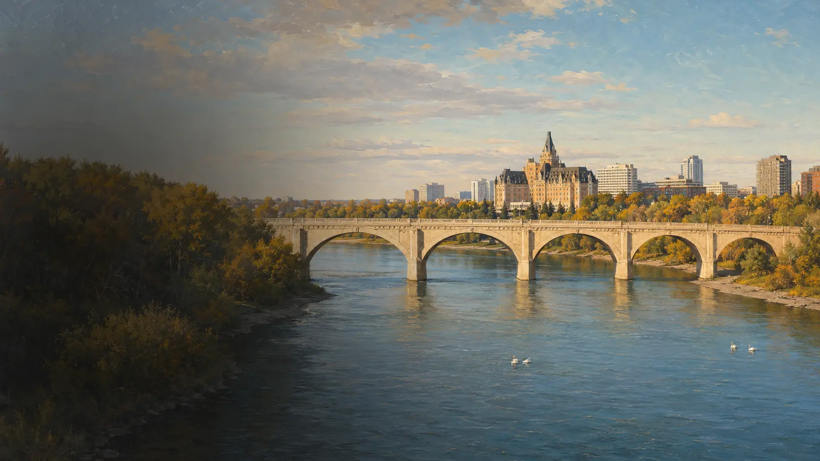
Saskatoon · South Saskatchewan River
A city shaped
by moving water.
Follow Saskatoon’s river corridor to read shifting bends, seasonal wildlife, living riverbanks, and the five arches of Broadway Bridge.
PLACESaskatoon
RIVERSouth Saskatchewan
WILDLIFEAmerican white pelican
BIG IDEARivers connect systems
Read the river corridor
One moving system holds a city, a trail, and a wildlife route together.
In Saskatoon, the South Saskatchewan River is more than a view through downtown. It moves sediment around bends, feeds cottonwood and willow habitat, gathers seasonal birds, and gives the city a green corridor crossed by landmark bridges.
 MAP · LOOK · CHECK CONDITIONS
Field habits for adults
Orient first; let the maintained route do the work.
Meewasin’s trail network follows both banks for more than 105 kilometres, but access and conditions can change. Use the official live map as the practical layer over this editorial overview.
- 01
Check the live mapConfirm trail access, closures, construction, and seasonal notices before setting out.
- 02
Stay back from hazardsUse public viewpoints and keep clear of unstable banks, fast water, and the weir.
- 03
Share the corridorKeep right, pass predictably, protect vegetation, and give wildlife generous distance.
Swimming is prohibited within Saskatoon city limits. Water levels and trail conditions can change quickly; always follow current City and Meewasin guidance.
A river in four readings
Look for change, connection, and structure.
The chapter’s observations point to four linked systems: flowing water shapes land, sediment records that movement, wildlife follows habitat, and bridges translate the valley into a human route.
Uneven current
Faster flow presses toward the outside of a bend; slower water gathers on the inside.
Moving sediment
Cut banks lose material while point bars collect sand, gravel, and new vegetation.
Seasonal movement
Pelicans, geese, deer, and beavers use the connected river valley for food and shelter.
Civic crossings
Bridges join neighbourhoods while keeping open space for the river below.
How a bend keeps changing
The outside cuts. The inside builds.
A meander is not a fixed curve. Current usually moves fastest along the outer bank, where it can remove soil. Across the channel, slower water releases sand and gravel, building a pale point bar.
- AccelerateThe main current leans toward the outside of the curve.
- ErodeFlow loosens material from the steep outer cut bank.
- SlowShallower water on the inside loses energy.
- DepositSand and gravel settle, extending the inner point bar.

A living ribbon through the city
The riverbank is movement habitat.
Cottonwoods, willows, side channels, gravel bars, and wet margins make a connected corridor. Tracks and browsed stems reveal animals that may remain out of sight.

Changes shorelines and side channels.
Hold food, cover, and nesting space.
Tracks, browse, feathers, and wakes.
A continuous green route through the city.

White wings over blue water
Pelicans make the river’s
seasonal pulse visible.
American white pelicans gather near Saskatoon’s weir from roughly April through October. Many are thought to commute from the breeding colony at Redberry Lake, northwest of the city.
A bird with a wingspan approaching three metres can still disappear into a broad prairie sky.
Watch their group feeding from a safe public viewpoint: several birds may move in a loose line, using bills and wakes to concentrate fish in shallow water. Stay well away from the weir.
 FIVE ARCHES · 355 METRES · OPENED 1932
Engineering the crossing
Broadway Bridge turns a steep valley into a civic route.
Opened in 1932, the 355-metre bridge spans the river in five concrete arches. Its deck rises at about a four percent grade because the Nutana bank stands more than 60 feet above the downtown side.
- 01
Curved structureEach arch carries compression toward its supporting piers and abutments.
- 02
Five open spansThe repeated openings create room for the river and frame long downstream views.
- 03
A rising deckThe arches increase in size toward the higher east bank, making the valley’s asymmetry visible.
The bridge is working infrastructure. Use designated pedestrian and cycling space and follow current construction or access notices.
A closer reading of the chapter
Four field notes for the adult explorer.
The supplied character journals are not reproduced here. Their core ideas are reframed as concise, research-backed context for orientation, geomorphology, ecology, and engineering.
Trail + bridge + bank → position
Name the landmarks before the details.
Identify the river direction, the bank you are on, and the nearest bridge. This simple frame makes every later observation easier to locate.
Fast outside + slow inside → bend
Read both banks as one process.
A steep eroding bank and a sandy bar across from it are paired evidence of the same current redistributing sediment.
Water + cover + food → corridor
Look for signs, not only animals.
Willow cuttings, tracks, feathers, and browsing record how deer, geese, beavers, and pelicans move through the river valley.
Arch + pier + grade → crossing
Let the bridge reveal the valley.
Broadway Bridge’s five arches and rising deck show both structural logic and the difference in height between Saskatoon’s two banks.
Find the chapter landscape
Saskatoon’s river corridor, in real geographic context.
The map centres the downtown South Saskatchewan River between Broadway Bridge and the weir area. Use it for orientation, then open Meewasin’s official live map for trails, distances, access points, and current notices.
Meewasin’s live map adds route names, distances, facilities, and access points.
The weir lies upstream of University Bridge; Broadway Bridge joins Nutana to downtown farther south.
Review current trail closures and City river-safety notices before visiting.
 Read the full chapterOpen Story 3 ↗
Continue the Prairie Adventure
Story 3
Following the South Saskatchewan River
Join Lumi, Aspen, Hazel, and Barrett along Saskatoon’s river valley, where pelicans gather, a changing bend exposes the force of moving water, and Broadway Bridge turns curved concrete into a safe crossing.
Opens the chapter page on the main Maple Explorers site.
Questions from curious explorers
River-valley notes, answered.
01Where is the South Saskatchewan River in Saskatoon?+
The river runs through the centre of Saskatoon. The Meewasin Valley trail network follows both banks and links natural areas, parks, bridges, and downtown viewpoints.
02What is the Meewasin Trail?+
Meewasin maintains more than 105 kilometres of trail on both sides of the river. The network passes under bridges and through landscaped parks, natural riverbank habitat, and cultural sites.
03When can I see American white pelicans?+
Meewasin reports pelicans at the Saskatoon weir from roughly April through October. Timing varies, so watch from safe public viewpoints and check current local information.
04Why do river bends change shape?+
Water usually moves faster along the outside of a bend, where it erodes the bank. Slower water on the inside drops sand and gravel, building a point bar and gradually shifting the bend.
05What is special about Broadway Bridge?+
The 1932 landmark is 355 metres long and crosses the river in five concrete arches. Its deck climbs at about a four percent grade because the east bank is more than 60 feet higher than downtown.
06What should I check before visiting?+
Check Meewasin and City of Saskatoon notices for current trail closures, water conditions, construction, and seasonal hazards. Swimming is prohibited within city limits, and visitors should stay safely away from the weir and unstable banks.
Research trail
Official sources behind the field guide
Trail geography, wildlife, bridge history, river processes, and visitor safety were checked against official and primary sources. Confirm current conditions directly before travelling.