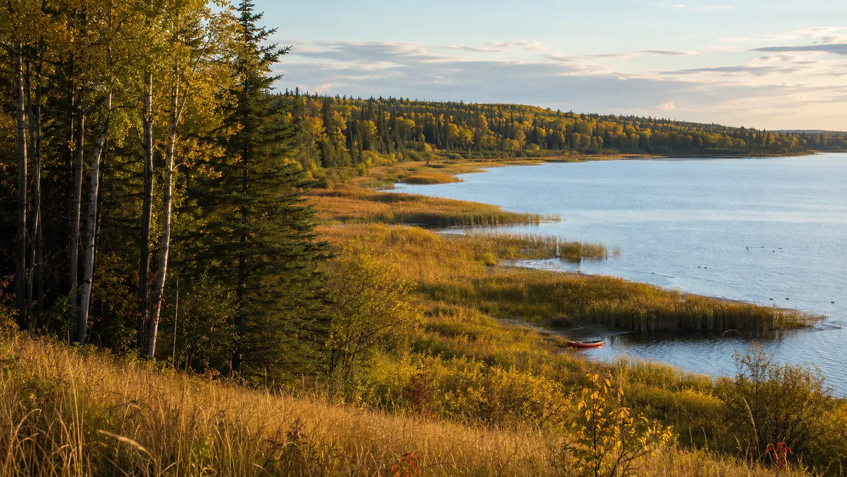
Prince Albert National Park · Saskatchewan
At the edge,
two worlds overlap.
Move from rough-fescue grassland toward Waskesiu’s lakes, wetlands, aspen, and spruce—and learn to read the living transition between prairie and boreal forest.
PLACEPrince Albert National Park
ECOSYSTEMPrairie–boreal transition
WATERWaskesiu Lake & wetlands
BIG IDEAAn ecotone is a living blend
Read the transition
Prince Albert National Park protects a broad meeting place.
Across 3,875 square kilometres of central Saskatchewan, rare rough-fescue grasslands, aspen parkland, mixedwood boreal forest, lakes, rivers, and wetlands form a changing mosaic. The southwest belongs to the boreal transition eco-region; farther north, forest and water dominate.
 MAP · WEATHER · WATERCRAFT PERMIT
Field habits for adults
Use Waskesiu as a base, then choose one habitat at a time.
Waskesiu Lake townsite is the park’s principal visitor hub. Roads and trails reach lakeshore, mixedwood forest, wetland boardwalks, and the southwest grasslands—but conditions and services vary by route and season.
- 01
Check current conditionsReview bulletins, trail reports, weather, fire information, and seasonal services before leaving town.
- 02
Prepare for open waterWear an approved life jacket, stay near shore, and expect wind and waves to change quickly.
- 03
Protect park watersEvery watercraft entering park waters requires a current aquatic-invasive-species certification permit.
Beaches and open water are not patrolled. Follow current Parks Canada requirements and be prepared to self-rescue if you paddle.
Four readings of the edge
An ecotone is visible in layers.
The story compresses a park-wide transition into one journey. In the real landscape, the change is gradual and uneven, shaped by water, fire, topography, soils, and time.
Light & openness
Fescue meadows receive full sun, while tree cover creates cooler shade and a different understory.
Forest structure
Trembling aspen, willow, spruce, fir, and pine occupy different combinations of moisture and disturbance.
Wet ground
Lakes, rivers, bogs, ponds, and marshes add aquatic habitat to the grassland–forest mosaic.
Crossing wildlife
Tracks, browsed twigs, cones, feathers, and lodges show how animals use several habitats.
Where communities overlap
An ecotone is a band, not a border.
A transition zone can contain elements of both neighbouring ecosystems along with its own edge conditions. At Prince Albert, the pattern unfolds over many kilometres and is continually reshaped by fire, succession, water, and climate.
- OpenRough-fescue meadow holds sunlight, grasses, and broad views.
- BlendAspen and willow break the grassland into groves and moist edges.
- EncloseMixedwood forest adds spruce, fir, pine, shade, and layered shelter.
- SoakWetlands and lakes connect aquatic life to the surrounding forest.

Water completes the mosaic
Wetlands concentrate food, cover, and evidence.
Prince Albert’s lakes, rivers, and wetlands are central to the park’s ecological integrity. Shallow water and willow margins can support insects, fish, birds, beavers, and large mammals such as moose.

Feeds insects, plants, fish, and birds.
Offers browse, building material, and cover.
Rearranges flow and wetland structure.
Links water, forest, and meadow.

PULL
LIFTMATCH THE RHYTHM
Teamwork on moving water
A canoe travels straight
when forces balance.
A forward stroke sends water backward and adds thrust. In a tandem canoe, paddlers normally work on opposite sides and coordinate their timing so one stroke does not overpower the other.
Small corrections are most effective before a gust becomes a broad turn.
A sweep or stern correction changes the canoe’s direction by creating a turning force. Technique comes second to safety: wear an approved life jacket, stay near shore, and turn back before wind and waves exceed the group’s skill.
 TRACKS · BROWSE · CONES · HABITAT EDGE
Read what remains
Wildlife signs connect habitats across time.
A brief sighting is only one moment. Tracks in damp soil, clipped willow ends, gnawed cones, feathers, scat, and pathways can reveal which animals crossed the edge before you arrived.
- 01
Start with substrateSoft mud, sand, snow, and fine trail dust preserve tracks more clearly than dry grass.
- 02
Match sign to foodWillow browse points toward herbivores; stripped cones often collect beneath squirrel feeding perches.
- 03
Leave evidence in placePhotograph from the route, keep wildlife distant, and never follow signs into closed or sensitive habitat.
Parks Canada recommends viewing large wildlife from at least 100 metres and always leaving animals an escape route.
A closer reading of the chapter
Four field notes for the adult explorer.
The supplied character journals are not reproduced here. Their central ideas are reframed as concise, research-backed context for geography, transition ecology, wildlife observation, and paddle safety.
Southwest grassland → Waskesiu mixedwood
Think park-wide, not fence-line.
The rare fescue meadows are strongest in the southwest. Waskesiu is a practical forest-and-lake base, while nearby routes reveal mixedwood, wetland, and lakeshore layers.
Light + moisture + fire → mosaic
The edge is always being revised.
Without disturbance, aspen can advance into open grassland. Parks Canada monitors grassland extent and uses carefully managed fire to support ecological integrity.
Food + shelter + water → movement
Animals use connections, not labels.
Moose may browse wet margins, deer cross meadow and forest, and beavers reshape shallow water. Signs often reveal this movement before animals appear.
Matched thrust + correction → direction
Rhythm helps; preparation matters more.
Coordinate strokes, wear an approved life jacket, stay close to shore, and watch wind. Secure the required park watercraft certification before launch.
Find the chapter landscape
One park, a broad south-to-north transition.
The map places Waskesiu Lake within Prince Albert National Park and shows the distance to the southwest grassland country. Use it for geographic orientation, then open Parks Canada’s current maps and conditions for exact routes.
The visitor centre, main beach, services, and several mixedwood/lakeshore routes are concentrated near town.
Fisher Trail and nearby Waskesiu routes pass through aspen, spruce, muskeg, rolling hills, and lakeshore.
Valleyview in the southwest crosses rare rough-fescue meadow, aspen forest, and sedge areas.
Parks Canada maps and current bulletins are the travel authority.
 Read the full chapterOpen Story 4 ↗
Continue the Prairie Adventure
Story 4
Where Forest Meets Prairie
Join Lumi, Aspen, Hazel, and Barrett at Prince Albert National Park as a search for an invisible border becomes a canoe journey through fescue, aspen, spruce, wetlands, wildlife signs, and the teamwork needed to stay on course.
Opens the chapter page on the main Maple Explorers site.
Questions from curious explorers
Park-edge notes, answered.
01Where is Prince Albert National Park?+
The park is in central Saskatchewan, about 90 kilometres north of the City of Prince Albert. Waskesiu Lake townsite is its main visitor hub.
02Why does the park contain prairie and forest?+
The park crosses a broad ecological transition. Rare rough-fescue grasslands occur in the southwest, while mixedwood boreal forest, lakes, rivers, and wetlands dominate farther north and around Waskesiu.
03What is an ecotone?+
An ecotone is a transition area where neighbouring ecological communities overlap and gradually blend. It is usually a band of changing conditions, not a sharp border.
04What wildlife might visitors see?+
The park supports bison, black bears, elk, moose, deer, wolves, foxes, beavers, waterfowl, and many smaller animals. Keep generous distance and follow current wildlife-safety guidance.
05Can visitors canoe in the park?+
Yes, but every watercraft entering park waters needs a current aquatic-invasive-species certification permit. Wear an approved life jacket, stay near shore, and prepare for changing wind and waves.
06What should I check before visiting?+
Check current important bulletins, trail conditions, weather, water-safety guidance, wildlife notices, fire information, and watercraft requirements through Parks Canada.
Research trail
Official sources behind the field guide
Geography, transition ecology, wildlife, trails, paddling, watercraft rules, and visitor safety were checked against current Parks Canada information. Confirm current conditions directly before travelling.